
By Saji and Salin
We had covered Phases I and II of our long journey in the Blue Jimny in Part 1 of our travelogue. Phase III of our journey is covered in this second part.
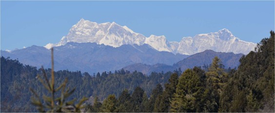
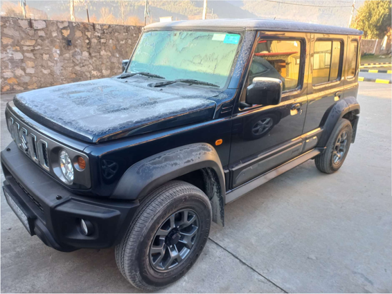
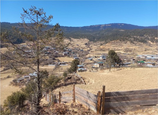
We have driven over much of Sikkim, and spent 18 days driving over a thousand kilometers through the state. Lachen and Gurudongmar lake were not open due to severe landslides a few months back. We hope to return to complete these two places in the future. The roads in Sikkim are narrow, some asphalted, but a lot of stretches landslide affected and temporary dirt and mud road. We did not have to use 4-wheel drive anywhere. Sikkimese are a very friendly people and we had great interactions with many people we met during this journey. It was orange season and we had bought a lot of oranges. They are small, but very sweet. Petrol was easily available everywhere except in Lachung, and we had to carry a jerrycan with 20 liters of petrol to return to Magan. The Jimny performed spectacularly on the good, bad and worse roads and it was very easy to give way to army trucks on narrow mountain roads. We had to obtain permits to visit East and North Sikkim. Other places such as Yuksom, Pelling, Gangtok and Yangsum did not require any permits.
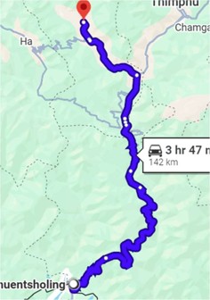
Day 30: January 8, 2026 : Jaldapara, to Phuentsholing, 29km, 4h
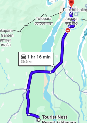
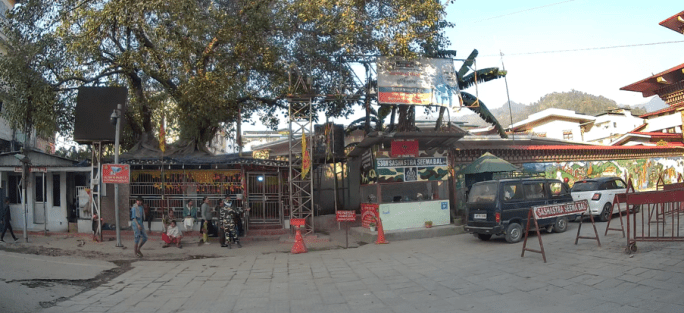
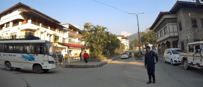
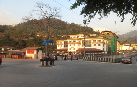
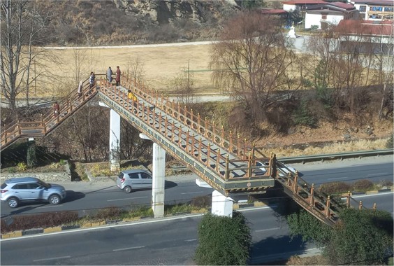
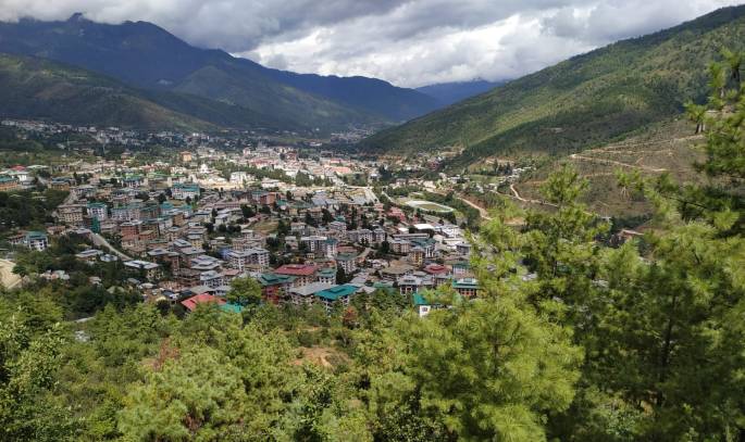
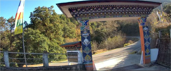
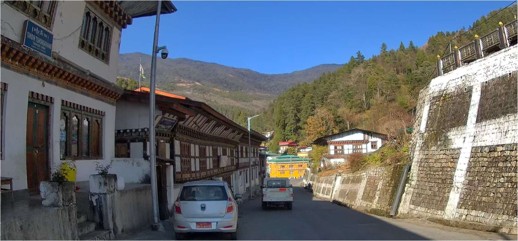
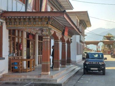
Today would be the day when the Jimny enters another country, Bhutan. We had contacted AV Travels in Jaigaon, regarding a ten day drive covering Paro, Thimphu, Punaka, Phobjika, Bumthang, Mongar and Trashigang and exiting Bhutan through Samdrup Jonkar into Assam. They were waiting or us and payment for the trip was made. We first crossed over to Bhutan through the pedestrian gate, showed our passports on the Indian side and then Bhutan side and was allowed to cross over to Phuentsholing. We crossed back into Jaigaon and AV travels entered the car data and generated a QR code for a 24 hour stay in Phuentsholing. We showed our passports to the Indian defence forces and then to the Bhutan police along with the QR code. We then checked into Hotel Phuentsholing. After resting a bit, we walked around Phuentsholing and explored the shops and restaurants. Phuentsholing is a pretty, neat and very organised town. The Bhutanese are very disciplined and obey traffic rules faithfully. No car horns are allowed in the town, and pedestrians cross the road only at the zebra crossing. When a pedestrian crosses, all traffic on both sides wait for them to cross. There are no traffic signals in Bhutan, and all junctions are managed by the very efficient traffic police. We found Phuentsholing to be inexpensive compared to the other Bhutanese towns. We had dinner at the hotel.
Phase III: Driving through Bhutan.
Bhutan, Nepal and Tibet Autonomous Region of China are open to Indian car drivers with the appropriate permits. It is possible to spend twenty four hours in Phuentsholing with the Aadhaar card. Driving is restricted to Phuentsholing. Many people come on a day trip and also fill up the much cheaper petrol. The first night in Phuentsholing was not part of our 11 day drive through Bhutan, in the sense that no payment was made.
Day 31: January 9, 2026 : Phuentsholing to Paro, 155 km, 6h 30m.
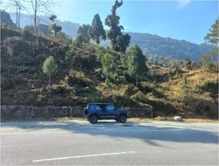
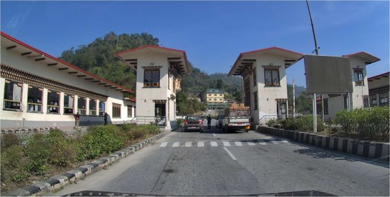
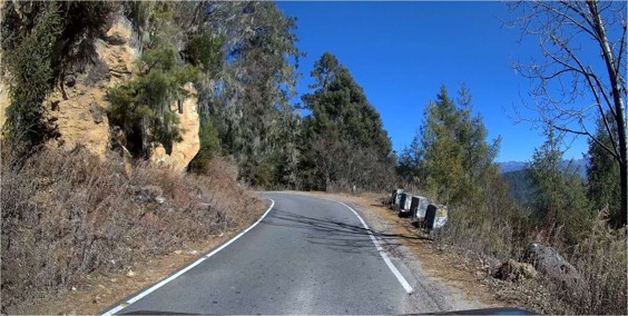
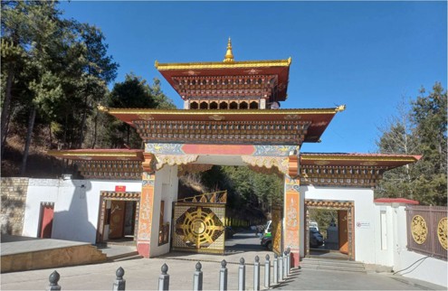
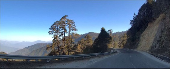
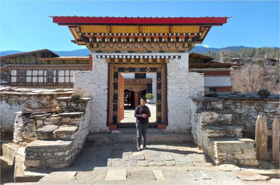
The guide came and met us while we were having breakfast. We checked out of the hotel and went to the Immigration office. The guide paid the fees for both of us; Rs. 1200 each per day, total Rs. 24,000 for ten days. Our passport was stamped with a visa and entry date. The immigration office is very close to the Bhutan gate, the entry to Phuentsholing. There is a petrol pump right next to the immigration office. We went there to fill up. Petrol costs Rs. 60 in Phuentsholing and a lot of Indian vehicles come here to fill up. Next, we went to the Motor vehicles department to pay for and get the vehicle permit. Shortly after leaving the petrol pump, we heard some vehicle sounding the horn. A traffic policeman signalled me to stop. The guide talked to him and assured him that it was not our vehicle. Good to have a Bhutanese guide with you. Vehicle permits cost Rs. 4500 per day, a total of Rs. 45,000 for the ten days in Bhutan. They generated a permit for ten days, mentioning the driver’s name and vehicle registration number. After that we were ready to drive to Paro. There is a first vehicle check point immediately after Phuentsholing. We cleared that and continued on the uphill road to Paro. The roads were in good condition and the traffic very disciplined. Silence on the roads, as no body sounds the horn. We allowed all local cars who were in a hurry to pass us, so we could drive leisurely and enjoy the beautiful scenery.
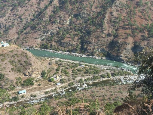
We stopped for lunch at a restaurant called Divine Midway. The view from the restaurant is beautiful. We continued the drive through the mountain roads with lovely scenery. A marten darted across the road, so quickly that there was no time to take a photo. We deviated from the Thimphu route at Chhuzom bridge and continued on to Paro. The road is adjacent to the Paro river all the way to Paro. We soon came to the Paro airport, one of the prettiest in the world. This is a tough airport to land and take off and very few pilots are certified to operate here. We stopped at a view point and were fortunate to see an aircraft take off and another landing.

After take-off, the aircraft has to ascend steeply to clear the nearby mountains, similarly, on landing the descent is quite steep. On one side of the airport the Paro river flows and the other side is a road.
The airport buildings are beautifully designed. The look out point is very popular with parents seeing off their children going abroad.
We then drove through the beautiful Paro town to our accommodation, the Riverfront resort. It is a beautifully designed hotel and the staff are very friendly and polite.
After checking in, we drove back to town to have a look at the shops and purchase some local handicraft.
It felt good to be driving the Jimny in Bhutan. With excellent roads, beautiful scenery, polite drivers and very little traffic, it was an enjoyable experience.
Day 32: January 10, 2026 : Climbing up the Tiger’s nest, Paro.
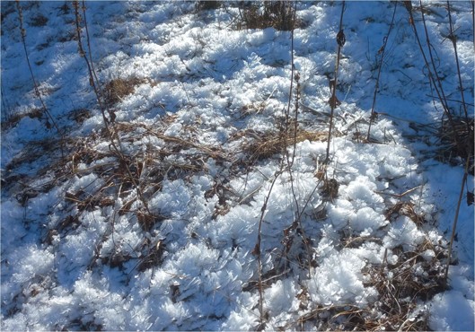
The night in Paro was cold at -3degC, and the windshield of the Jimny was frosted over with a thin layer of ice. It took some time to defrost the windshield and clear the windows.
We had breakfast and set out to the entry point of the Tiger’s nest trek. We had carried our old trekking poles for the climb up. After parking the Jimny, we bought the entry tickets and started the trek. Initially, it was gradual and we did not feel much difficulty in climbing. There were steps to climb and after a couple of hours we reached the halfway point and stopped at the café to have a tea.
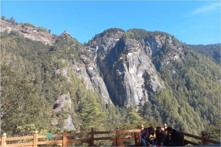
Continued the climb and towards the top, the Tiger’s nest Monastery came into view.
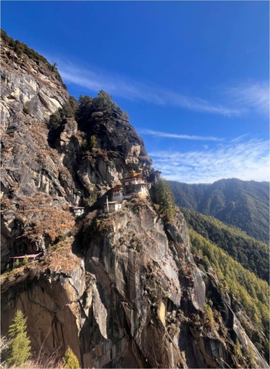
The path then consists of descending steps and that was a bit difficult. The descent continues to a lovely waterfall with ice on the borders. Then there is a steep climb up to the monastery. This part is a bit tough and exhausting after climbing for four hours. Young, fit persons can easily do the climb in three hours, but we were neither young nor fit. We visited the monastery rooms and then descended the steps to the waterfall. Then the ascent was a bit difficult. Once we reached the top, it was downhill all the way to the café. Once again stopped at the café for tea and a bit of rest, and spent some time talking to fellow travellers. Walked down to the parking lot, which took another two hours. It was dark by then and we had to use the mobile light to see the way. Drove back to the hotel and had dinner. We were feeling exhausted and slept early.
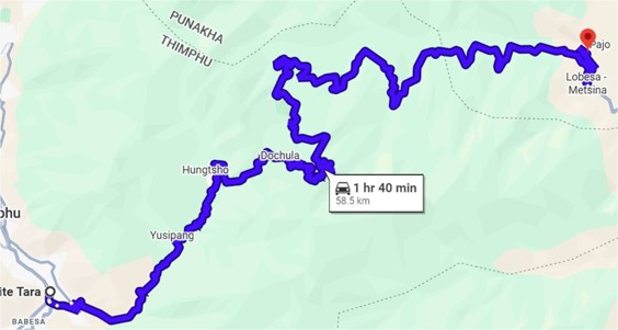
Day 33: January 11, 2026 : Paro to Haa and then to Thimphu, 187km, 8h 30m.
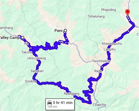
The previous day, Suresh Stephen, a friend in Bangalore had suggested we visit Haa valley. I asked the guide whether we were allowed to visit Haa. He said no problem, the vehicle permit allows us to visit all non-restricted parts of Bhutan.
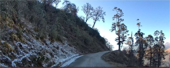
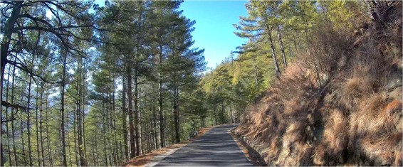
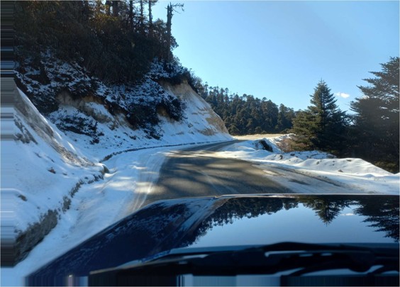
We filled up petrol and drove to Haa valley. The road up to Chela pass was very scenic with pine forest on both sides of the road, and hardly any traffic. After some time, we saw snow on both sides of the road. The snow was not powdery, but in the form of flakes.
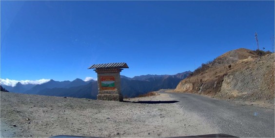
The road climbed up to Chele la pass. We stopped to view the beautiful scenery and take photos.
From Chele la, the road descends to Haa valley.
The road is generally good and it was a beautiful drive to Haa. There was hardly any traffic on this route. We first went to Damthang, the last village where the road ends. Drove back to Haa and visited the Indian Army establishment. Bought some items from the army store and talked to the personnel there. The army canteen was closed when we reached, so we continued the drive to Thimphu. There are a few small villages along the route, but we couldn’t find a restaurant to have lunch. After driving for a couple of hours, we found a restaurant for lunch. After lunch continued driving to Thimphu and reached about 6pm. We checked into Hotel White Tara, a very nice hotel. We had dinner there and retired for the night.
Day 34: January 12, 2026 : Thimphu to Punaka; 105km, 7h.
After breakfast, we checked out of Hotel White Tara.
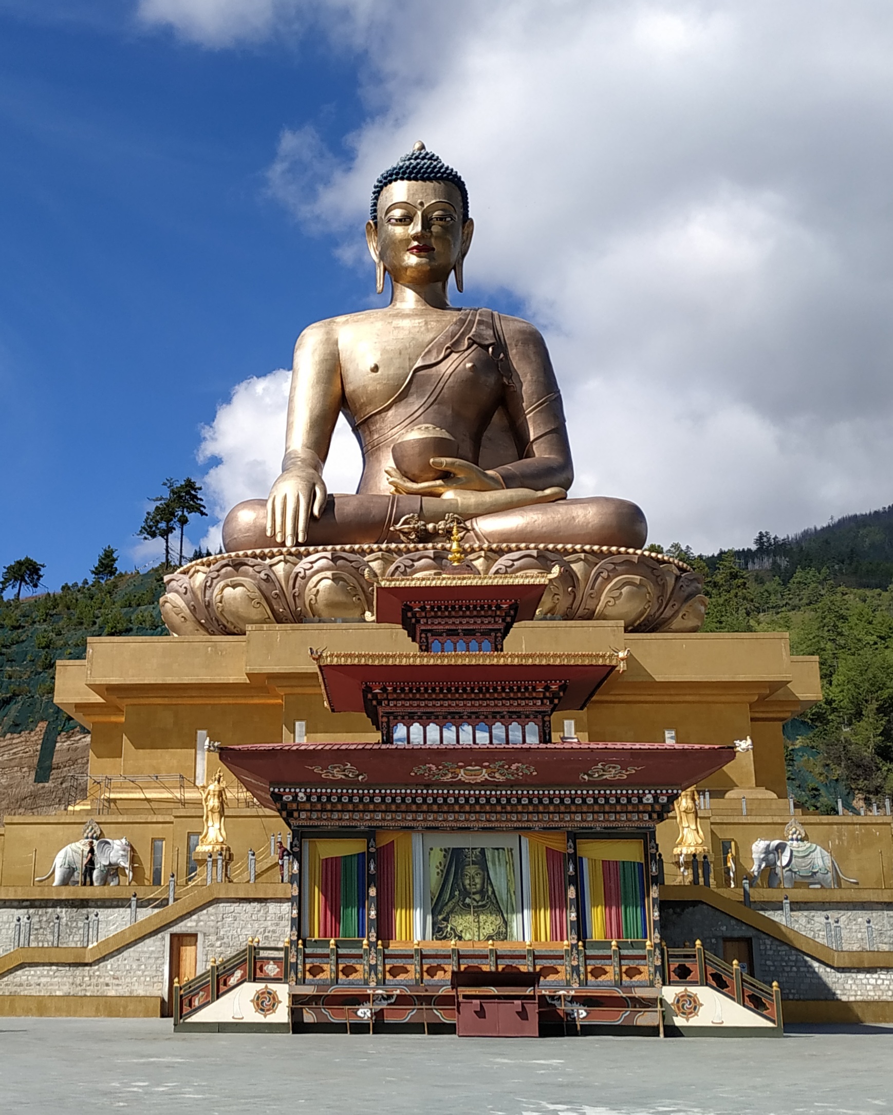
We drove around Thimphu and then to Buddha Dordenma, a complex with a giant statue of Buddha. It is an interesting place and we spent over an hour looking at the various statues. Buddha Dordenma is a 54-metre bronze statue plated in gold. There are 125,000 smaller Buddha statues in the complex.
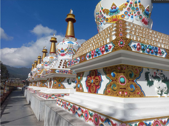
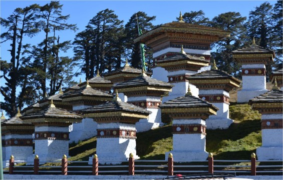
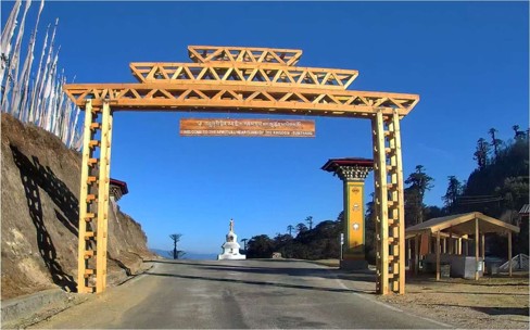
After visiting the complex, we stopped to have a look at Thimphu from the heights and drove to a petrol pump to fill petrol. Petrol cost was Rs. 63.44. Afterwards, we drove to Punakha. On the way we stopped at Dochula Pass, where we saw 108 memorial chortens in memory of the 108 Bhutanese soldiers who died fighting rebel groups from India in 2003. The view from the pass is very lovely.
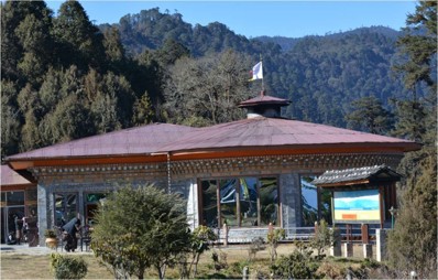
After spending some time at Dochula pass and having tea at the café, we drove to Punakha. The road was double lane in good condition and traffic was minimal.
We reached our homestay in Punakha at 5 pm.
Day 35: January 13, 2026 : Punaka to Phobjikha, 99km, 6h 10m
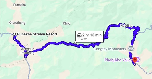
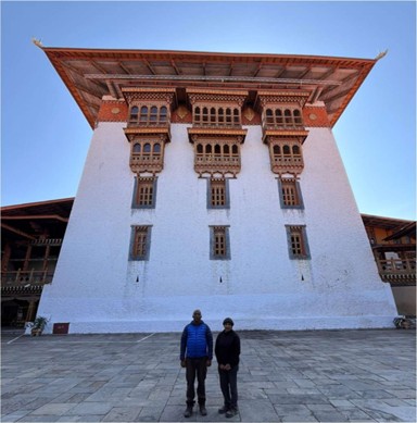
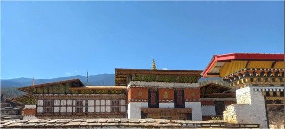
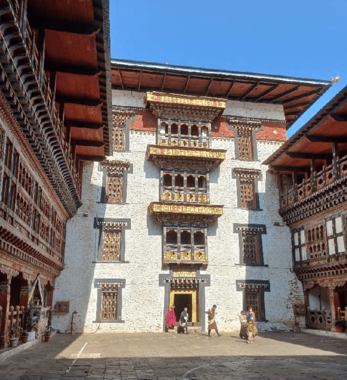
We checked out of Punakha Stream Resort after breakfast and drove to Wangdue Phodrang Dzong, a magnificient complex consisting of a fort, monastery, administrative buildings. The old complex built in the seventeenth century burned down in 2012 and was beautifully restored and opened in 2022.
After visiting the dzong, we filled up petrol and continued the drive to Phobjikha.
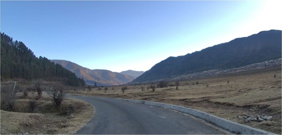
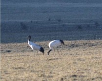
The road to Phobjikha takes a right turn from the Trongsa road. The road becomes narrower and in places dirt. There was snow on the roadside. The Phobjikha Valley is a vast U-shaped valley at an elevation of 3000m in central Bhutan. The valley houses the ancient Gangteng Monastery. The black- necked cranes arrive from the Tibetan Plateau to visit the valley during the winter season to roost in the last week of October. It is interesting that only underground electrical powerlines are permitted in the valley to protect the cranes. The valley is popular with bird watchers, otherwise it is off the tourist trail. There were many black necked cranes when we visited.
Day 36: January 14, 2026 : Phobjita to Bumthang, 150km, 7h 40m.
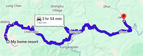
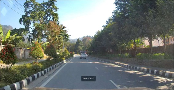
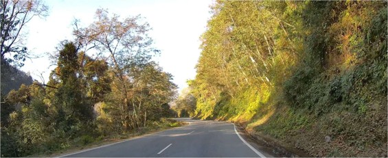
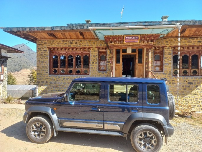
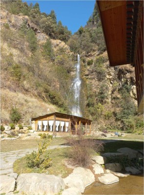
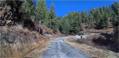
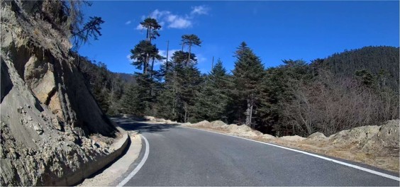
After breakfast at My Home Resort, we packed up and got ready to leave for Bumthang. We saw a number of black necked cranes close to the homestay. We drove on the road to the junction where the Phobjikha road joins the road to Trongsa. The drive passed through small towns and villages. The road from the border town of Gelephu joins the main highway to Bumthang at Torngsa,. After driving for 75 km, we came across a café called Willing Waterfall Café in front of a waterfall. We spent over an hour in this lovely place and had coffee. The road was two lane and in good condition with minimal traffic. The central and eastern parts of Bhutan are not on the main tourist trail, which includes Phuentsholig, Paro, Thimphu and Punakha.
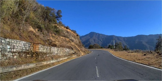
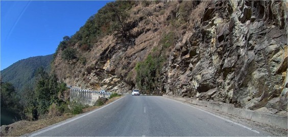
The road was well maintained and the drainage was properly taken care off. We did not see any road maintenance personnel anywhere. In places where landslides had damaged the road, prompt action was taken to restore it. The excellent road coupled with beautiful scenery, minimal traffic, absence of people and animals on the road, made it a dream drive. To add to this, the low cost of petrol, around 65 rupees a liter made it even better.
Day 37: January 15, 2026 : Exploring Bumthang.
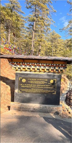
After breakfast at the homestay, we set out to explore Jambay Lhakhang, Bumthang, one of the oldest temples in Bhutan. Jambay Lhakhang was built in the early 6th Century by the Tibetan King Songtsen Gampo, who is believed to have introduced Buddhism to Bhutan. Jambay Lhakhang is one of the 108 temples built by King Songtsen Gampo to subdue a giant ogress who obstructed the spread of Buddhism in the Himalayas. After subjugation, the body of the ogress was laid across the Himalayas and the King built 108 temples over the body of which the Kyichu Lhakhang is said to be constructed on the left knee of the ogress. The Lhakhang was visited by Guru Rinpoche and contains treasures related to Buddhism.
We visited Mebartsho, (Burning Lake). This place gets its name from the action of Pema Lingpa, who discovered sacred treasures hidden by Guru Rinpoche in this lake. He astounded the local people by holding a butter lamp that remained lit even while he descended to the bottom of the lake. His feat convinced the people to convert to Buddhism.
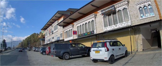
We then visited Bumthang town and had lunch in Subba Restaurant.
After lunch we returned to Kaila Guest House.
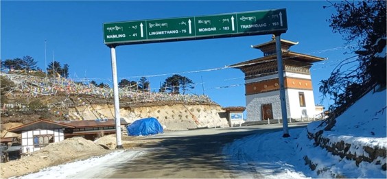
Day 38: January 16, 2026 : Bumthang to Mongar, 189km, 8h 15m.
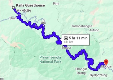
We had breakfast at Kaila guest house and took the road to Mongar.
The road was narrow, but there was hardly any traffic.
The road started to ascend and soon we were seeing snow on the road.
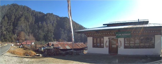
Central and eastern Bhutan are sparsely populated and we found AP Zow restaurant in Sengor village after a long while. Unfortunately for us, they had no food available, so we moved on.
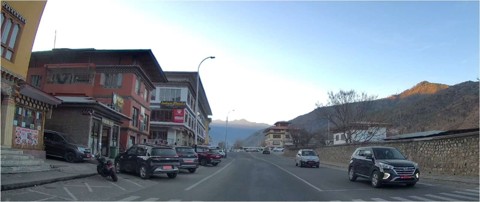
We stopped at a small restaurant and had lunch. The road afterwards was under construction in places and we had to wait for the activity to stop. Continued the drive through the mountain roads and reached Mongar in the evening and checked into Wangchuck Hotel.
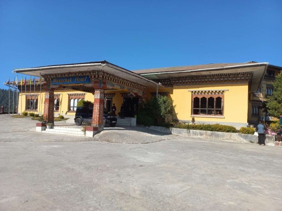
This is a nice hotel perched above Mongar town. Relaxed for a bit and had dinner.
Day 39: January 17, 2026 : Mongar to Trashigang, 90km, 4h 15m.
We spent the morning exploring Mongar town and watched children practice tennis at the public gardens. Filled up petrol and drove to Trashigang. The road was through the mountains and well maintained.
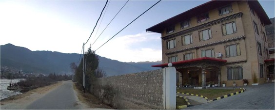
Drove to the Druk Deothjung Resort, perched high above the road. The road to the resort from the main road was under construction and full of stones and had to use 4WD to climb up. The view from the resort is great.
We had a very spacious room. Drove to Trashigang to explore the town and have lunch. Afterwards returned to the resort and had dinner and retired to sleep.
Day 40: January 18, 2026 : Trashigang
I had a persistent cough all night and wasn’t feeling well. We had breakfast at the resort and set out to explore the town. First we visited the Trashigang hospital to seek a remedy to my persistent cough. They took my blood pressure and oxygen levels and a doctor did a thorough stethoscope examination. He gave paracetamol, vitamin tablets and allergy tablets. Hospital consultation and medicines were free. The hospital was not at all crowded and was very nice and neat.
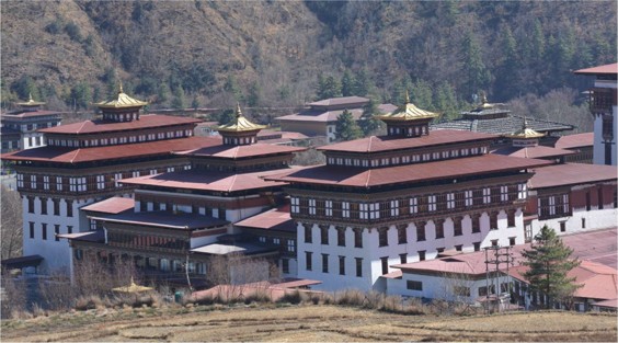
Then we drove to Trashigang Dzong and had a look around.
We then drove 17km to Rangjung Woesel Choling Dratshang in Rangjung over narrow roads. Walked up the stairs and had a look at the temple complex. After some time we walked back to the car park and looked around for a restaurant for lunch. Finally decided to go to Trashigang and have lunch there. We drove to the same restaurant we had lunch the previous day. After lunch, returned to the hotel and rested. Had dinner and packed up to leave.
Day 41: January 19, 2026 : Trashigang to Samdrup Jonkar to Guwahati, 292km, 12h.
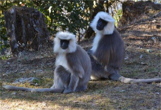
Had breakfast, packed and checked out of the hotel. Started the drive at 0930. Sonam, our guide, drove and the road climbed from Trashigang and passed through forest. The road was good, and not many houses or people on the road. We passed some very small towns. There was hardly any traffic and it was a pleasant drive. On the way we saw a group of golden langur. Stopped at Wamrong for a bio break. It was a festival day in Bhutan and all the shops were closed. We did not have lunch or coffee. We stopped at the first petrol pump approaching Samdrup Jonkar. The attendant refused to fuel up Indian vehicles, but Sonam convinced him to do so. Filled up the tank and proceeded to Samdrup Jonkar. There was a Bhutan police checkpost outside town and we had to show the vehicle permit. Proceeded to Bhutan immigration and the passport was stamped exit. We bid bye to Sonam and passed through to Indian side. There was no further checking by the Bhutan police. The BSF stopped us and I had to enter vehicle details in their ledger. A customs person showed interest in the luggage in the Jimny, but we told him it was all clothes and jerry cans etc. The mobile data did not work, so we drove straight to Tamulpur and Rangia. After some time, maps came on and we continued on. Stopped for tea and resumed the drive. On the outskirts of Guwahati, we encountered heavy traffic and progress was slow. This continued on till we reached the Saraighat bridge over the Brahmaputra. After that traffic cleared and we reached Aprila by 8:30 pm. It was a relief to park and settle in Aprila. Reeturaj came to visit shortly after we arrived. Had dinner and went to sleep.
This concludes phase III of our travel till Bhutan. Our journey continued through Assam, Meghalaya, Tripura, Mizoram, Nagaland and Arunachal Pradesh, before crossing over from the easternmost point of India to the westernmost point, the Rann of Kutch in Gujarat. The account of the remaining travels will be posted later.
