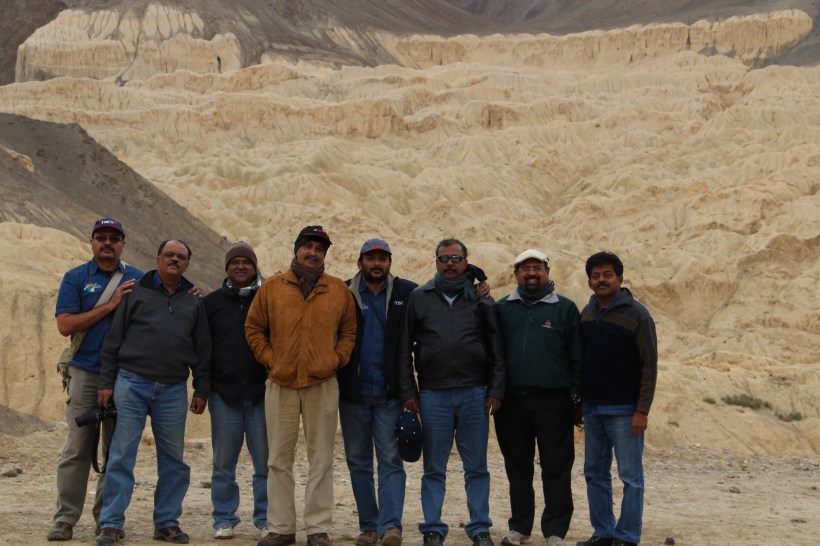
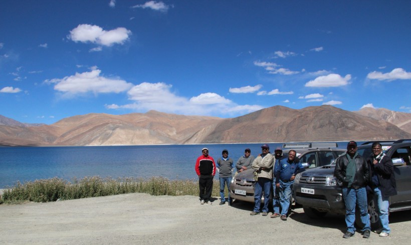
by JAYAPRAKASH P
Himachal Pradesh – Lahaul & Spity Valley
Day 13 – September 22, 2013 : Patseo – Kaza : 225 km
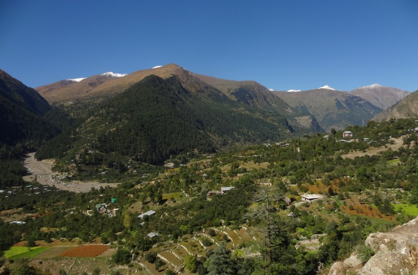
About an hour after starting from Patseo, we suddenly started seeing quite a bit of vegetation, and wow ! the beautiful village of Jispa came into view.
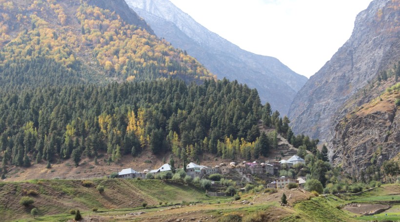
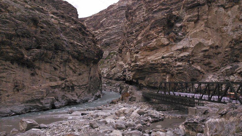
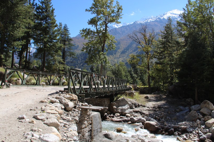
Jispa (10,500 ft.) has all the makings of a beautiful European village, and we could understand why many travel blogs have recommended Jispa as the ideal place to halt, during the journey from Manali to Leh. On the way Tandi is an important place for drivers, as it has the only fuel station, catering to a very large area. The road becomes quite bad after Tandi, and we finally reached Gramphoo, at noon, where we had our customary Maggi noodles. The signboard at Gramphoo innocently states the distance to Kaza as 137 kms. And, for the first few kilometers, the road surface was reasonably good, barring the sites of the many water crossings that we came across, which were really tough for the Innova. The road continued like this till Chhatdu, where we saw a rather quaint bridge, which came as a surprise. The worst was yet to come ! After Chhatdu, the track (it was no longer a road) went right through the rocky, river bed. We literally hobbled along, bouncing over rocks, trying to avoid deep holes on the track, and at times wading through a stream of water. At one point, the Innova had to be towed out of a rut by the 4 Wheel Drive Fortuner.
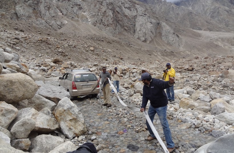
There was a general air of anxiety and irritation in the team, when a biker riding across commented that the road condition ahead was still worse. After about 20 kms of the hellish track, we saw some marginal improvement in the road condition, and we somehow maneuvered our vehicles into Batal, which is located right in the middle of the riverbed.
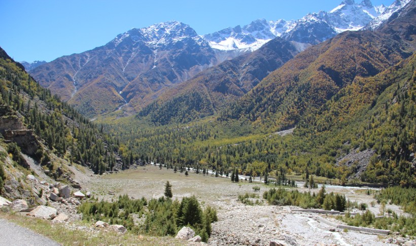
Batal, and earlier Chhatdu, were the only two places along the 76 kms stretch between Gramphoo and Losar, where we saw any human habitation ! We saw an HPTDC Rest House also in Batal, which could have come handy for many an unsuspecting traveler coming this way. The climb to Kunzum La starts shortly thereafter, and we reach the summit, where a desolate Buddhist shrine stands alone. A fellow traveler whom we met at Batal had told us that it is customary for the travelers on this route, to drive around the shrine; and we did not break the custom.
Nobody in the team will forget the drive from Batal to Kaza, where there were no proper roads, no network connectivity (No Google Maps) and not even a human being in the vicinity. Luckily for us, the Sygic Maps on Ninan’s phone worked and the duo of Fenwick and Ninan did a wonderful job of driving and navigating, thereby guiding the team to safety. It was well into the night when we drove into Kaza, which was pitch dark, due to a total power failure. Our host, Mr. Tsering, was waiting for us, and we were soon lodged in comfortable rooms, which lacked only electricity.
Day 14 – September 23, 2013 : Kaza
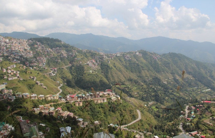
The morning view of Kaza from the hotel was so beautiful that we spent more time for breakfast, in the company of our host, who was very knowledgeable. He explained the history of the place and the way of life of the villagers. With his guidance, we planned the program for the day in Kaza.
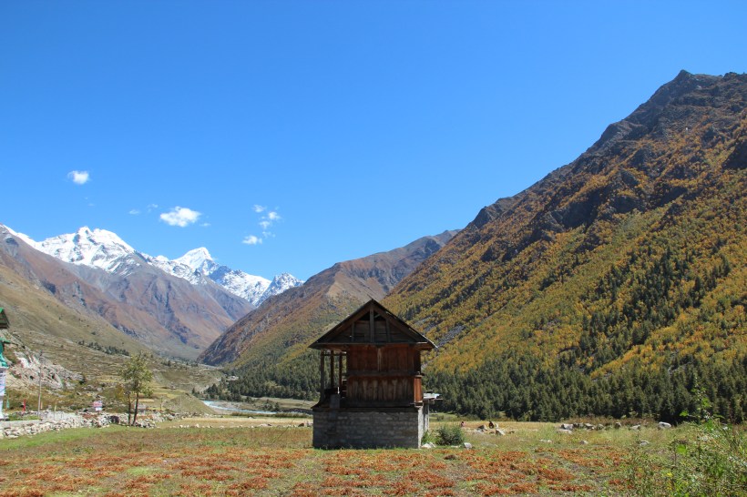
The road to the nearby villages was a steep climb, and we got much above Kaza town, in a short while. We soon reached Langza village, with a number of traditional Ladakhi houses, and a colourful, huge statue of Lord Budha overlooking the valley.
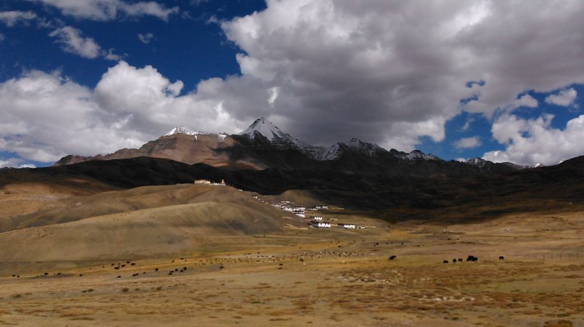
Our next destination was Komic village, just a few kilometers from Langza. Situated at an altitude of about 15,050 ft. in a bowl shaped depression in the Himalayan ranges, Komic village is regarded as the highest motor-able village in the world.
Surrounded by snow bound mountains and majestic valleys, this village attracts countless tourists for its breathtaking beauty. As the land is totally barren, there is no cultivation and the villagers earn their livelihood by rearing sheep and yaks. This village will be completely cut off from the rest of the country due to heavy snowfall during winter. We were told that the villagers store enough food to last the winter season during which they stay indoors and utilize the time for doing handicrafts and paintings.
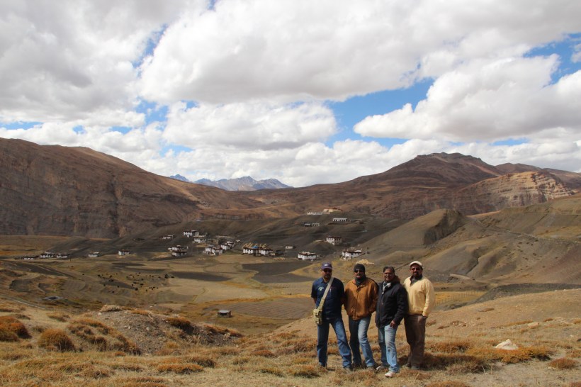
The hills and valleys near this village are famous for Fossils but we could not get any specific directions to the Fossil area. We were lucky to spot a self-styled guide with a cowboy hat, who happily agreed to help us. A 10-minute walk took us to a small stream, whose bed had a number of fossil items. The presence of these sea-based fossils confirms the theory that Himalayas have come up as a result of the collision of continents.
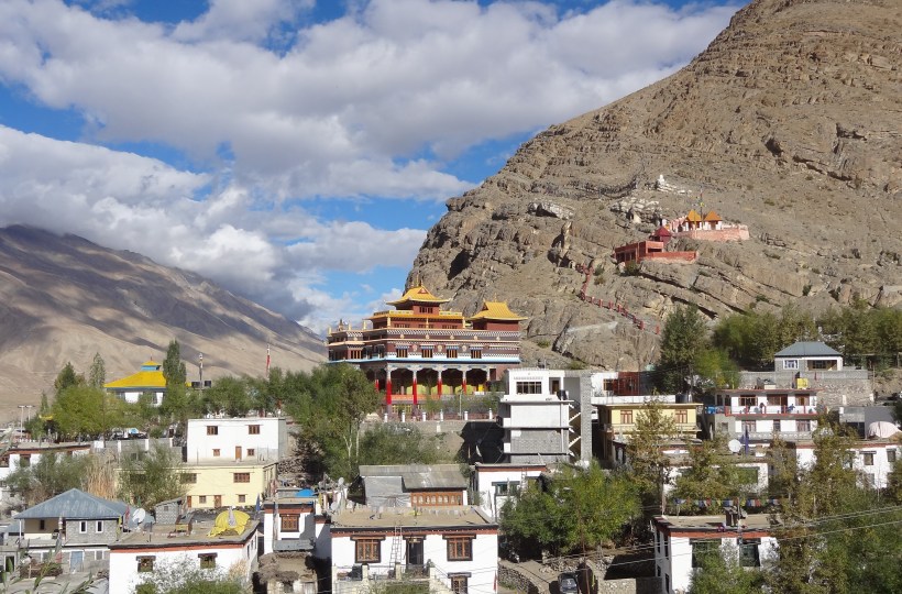
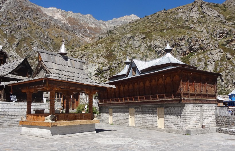
Tangyud Gompa located at the entrance of the village is said to be more than 500 years old. This monastery is built like a fort overlooking the town of Kaza, with mud walls painted in bright colours.
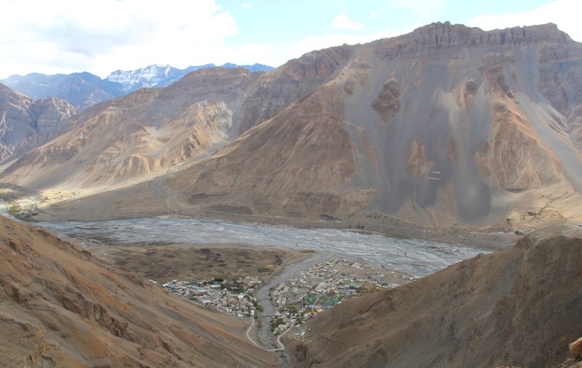
We took a different route for our return, through Hikkim village, and were rewarded with a breath-taking view of Kaza town, and Spiti River, from a very high vantage point. The Indian Oil Petrol Pump at Kaza, has a small board proclaiming it to be the highest retail petrol outlet in the world.
Day 15 – September 24, 2013 : Kaza – Recong Peo : 210 km
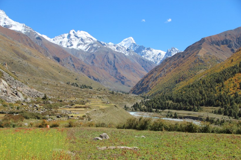
The road from Kaza to Simla (via Puh) runs alongside Spiti River all the way up to Khab. We took the small 10 km detour from the main road, just before Sumdo, to visit the mummy of the Lama at Gue village. It is believed that the mummy belongs to a monk, who meditated himself to death, apparently to save the village from destruction.
Sumdo, being just 18 kms from the China border, has a heavy military presence, and all the vehicles have to be stopped, identified and cleared. A river from China joins Spiti at Sumdo. We had our brunch, consisting of Thukpa and Momos, further ahead at Chango, which had a small collection of eateries.
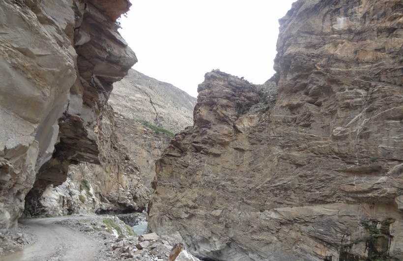
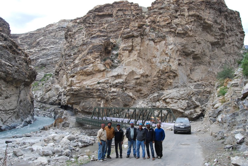
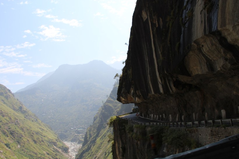
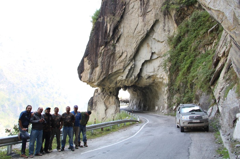
Later, we passed the dreaded `Malling Nullah’, the falling rock region, without any mishaps. The road to the next village Nako remained in the usual run-down condition, with BRO constantly working on it. From Nako, the road makes a steep descent into the rocky terrain of Khab.
The craggy nature of the rocks, through which the road runs into Khab, is pretty fascinating and prompted us to stop, and pose for photos.
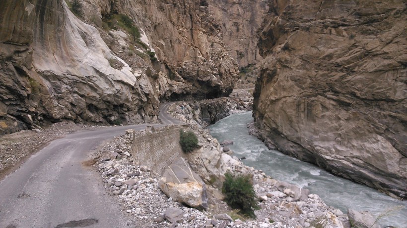
At Khab, the muddy waters of Satluj, coming in from China, joins the clear water of Spiti which had been flowing alongside our road for so long.
Puh (or Poo) is predominantly a military town. The whole road had been blocked the day before our travel, owing to a large landslide, the remnants of which were still visible, as we passed by. After a few hours of anxiety, we finally stopped for the night at a way side hotel at Reckong Peo, a crowded, commercial place. Our plan was to reach Kalpa (9710 ft.), located 10 kilometers further up the hills from Reckong Peo, but could not make it.
Day 16 – September 25, 2013 : Recong Peo – Sangla : 55 km
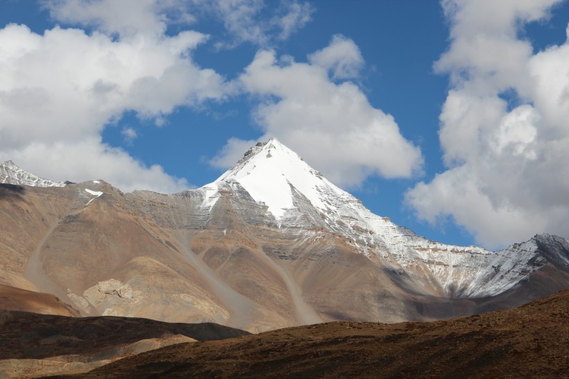
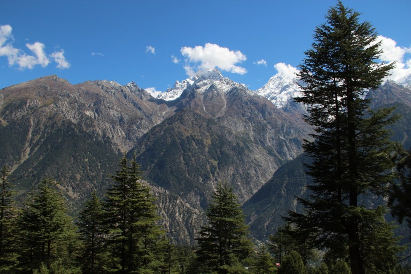
The beautiful winding road with smooth tarmac running between pine trees was a delight to drive on and shortly we reached Kalpa, a popular tourist destination. Kalpa is famous for the stunning view of the revered Kinner Kailash mountains.
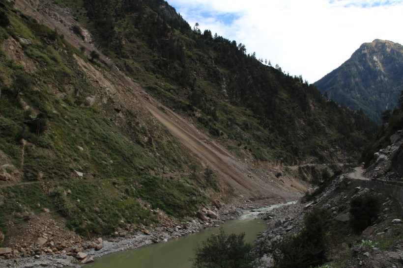
Our next destination was rather close by – Sangla. On travelling hardly 20 kms from Reckong Peo, we reached Karchham, where we saw a dam and power plant built a few years back. Some environmentalists (including our host in Kaza) were of the opinion that the callous construction has increased the incidence of landslides in the area. We turn into Sangla Valley at Karchham, and immediately the remnants of a massive landslide, which had totally blocked the main road, greeted us, as if corroborating the above view.
The temporary road made by BRO to bypass the landslide hit area was not a big concern for us, considering the treacherous roads (tracks) we already conquered. Our accommodation in Sangla was arranged in the Forest Rest House. The Rest House was constructed in 1908 and was surprisingly well-maintained.
Day 17 – September 26, 2013 : Sangla
Next day we set off to Chitkul (11,320 ft) located at the end of Sangla valley, just 22 kms away. Immediately outside the Sangla town, we get a breathtaking view of the Sangla valley.
A couple of beautiful streams cross the road, including the Ganga Rang, coming down the Kinner Kailash mountain. We collected the `holy’ water from Ganga in our bottles, which should be the purest of natural mineral water.
After so many days of adventurous drives, we chose this day to relax, enjoying the nature, at this wonderfully beautiful village of Chitkul.
The Mata Devi temple, constructed in the unique Kinnauri style, mostly using Deodhar wood, was an interesting sight in Chitkul.
Day 18 – September 27, 2013 : Sangla – Rampur : 130 km
We started for our next destination, Rampur, in the morning. The scenic road was made by cutting a groove through rocks in the mountains and we had to stop at many locations to click pictures.
From Jeori, we take the 14-km long zigzag road to Sarahan (7500 ft), another popular tourist destination. Sarahan is also important as the seat of the erstwhile Busharhr kingdom. After lunch at a modern restaurant, we proceeded to Rampur, a commercial town, at an altitude of only 4000 ft. Our stay at the HPTDC hotel, Bushahr Regency, was really comfortable.
Day 19 – September 28, 2013 : Rampur – Chandigarh : 260 km
The last leg of the journey from Rampur to Chandigarh, via Shimla, was uneventful, the only highlight being the cool, misty environs of Narkhanda.
At Shimla we searched and found a Toyota Service Centre, where we got both of our vehicles checked, to see if the rocky terrain we traversed had caused any damage. To our relief, both the cars were fine, with only some minor scratches in the underbody, that didn’t need any repair work. A full body wash was the only service required and the cars were ready within a couple of hours. We reached Chandigarh by evening and checked into a hotel. A small party to celebrate our accomplishment followed.
Days 20 – 22 : September 29 – October 1, 2013 : Chandigarh – Bangalore : 2510 km
Five members of the team had booked their return flight from Chandigarh to Bangalore and they left for the Airport early in the morning. The remaining three of us continued our return drive to Jaipur in two vehicles. We reached Jaipur by evening and returned the Innova to Bosch. After completing the formalities without much delay, we continued our drive in the Fortuner and reached a place called Bundi, where we checked into an RTDC Hotel for the night stay.
Our plan was to take a different route for the journey back home – that is, to travel across central India from Rajasthan, through Madhya Pradesh, Maharashtra and Andhra Pradesh. But after travelling a few hours, to our dismay, we found that the roads were pathetic for long stretches and our progress was very slow. The so called State Highways and National Highways turned out to be worse than country roads.
To make up for the lost time, we decided to continue driving by taking turns – one person driving, one navigating and the other, sleeping in the back seat of the car. This was the first time we continued driving through the night. We rested for a while and got refreshed at a Guest House near Nizamabad. To our relief, the roads from Nizamabad to Bangalore through Hyderabad were excellent and we reached Bangalore by 8.30 PM on 1st October. We were so glad that we completed the trip without any problems for any of us or the vehicles.

The wonderful journey had come to an end, but the memories remain. All of us felt that we should drive to Ladakh once again and enjoy some places we left out during this trip because of shortage of time. Places like Parakchik and Rangdum in Suru Zanskar valley, Kiagar Tso and Tso Morriri in Changthang Desert, Chushul and Hanle…etc.
In fact, the trip to Ladakh had given us the confidence to undertake many more such trips to exotic destinations like Sikkim, Arunachal Pradesh and Bhutan.