
by JAYAPRAKASH P
Mesmerizing Ladakh – Leh, Nubra Valley and Pangong Lake
The Ladakh region is at a high altitude, ranging from 11,000 to 18,000 feet. The rapid exposure to low amounts of Oxygen at high elevation can cause Acute Mountain Sickness (AMS) with symptoms of head ache, nausea, tiredness and dizziness. The Srinagar – Kargil route, which we have chosen, offers gradual climb and the night halt at Kargil (8,800 feet) helped us to acclimatize.
Day 8 – September 17, 2013 : Leh
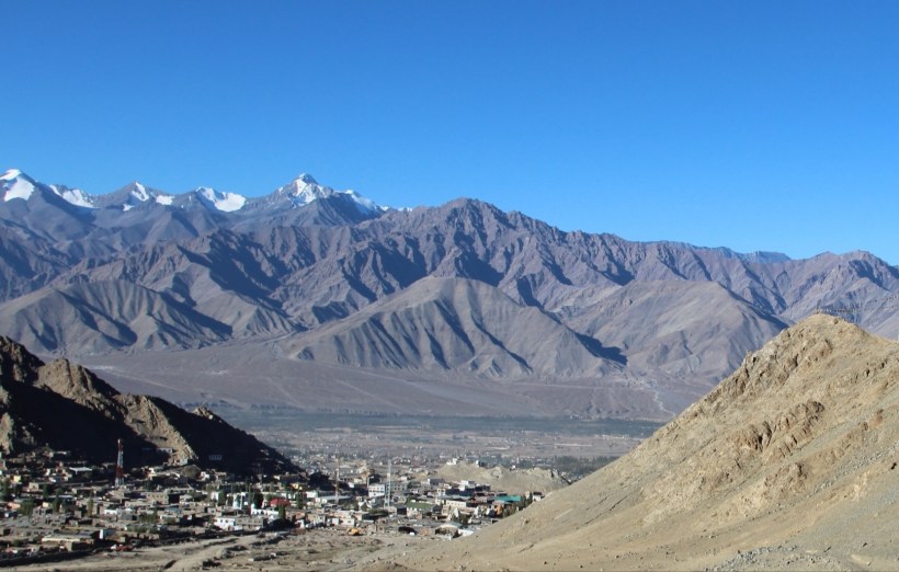
We spent the day in the town for acclimatization and walked around enjoying the distant views of snowcapped mountains. We could find a number of tourists, including foreigners in the shops and markets. Curiously, almost all the vendors in the Tibetan market were women, a reflection of the general trend we found in the region – ie, the womenfolk seeming to do all the hard work. We found a Car Service Station nearby and got our vehicles serviced.
A few of us visited the ancient Himalayan Monastery, Hemis Gompa, which is supposed to be built before the 11th Century.
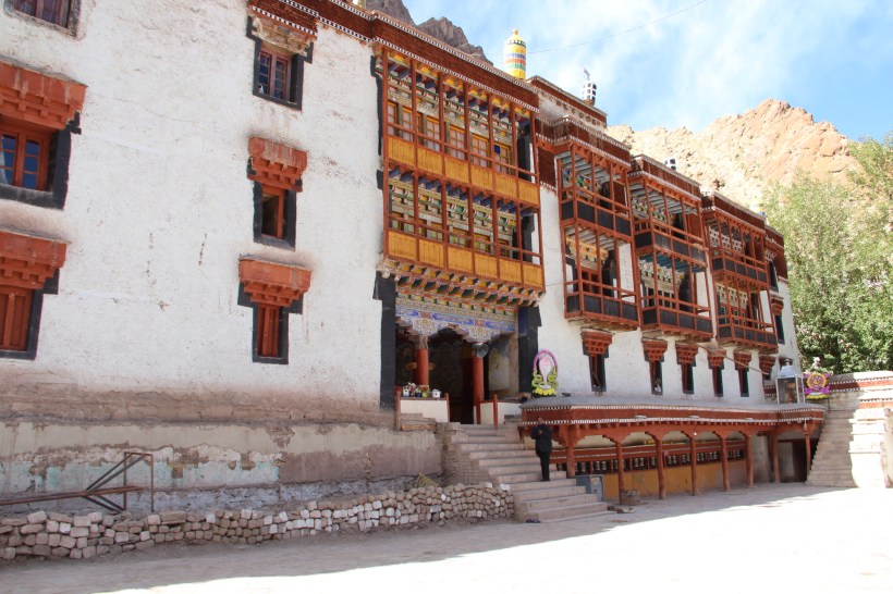
Situated about 40km from Leh, this Monastery was re-established by a Ladakhi King in 1672.

This Budhist Monastery has a peculiar link to Christianity. In 1887, the Russian Journalist Nicolas Notovitch had written a book `The life of Saint Issa’ claiming to be the translation of a manuscript held in Hemis Library. He had portrayed Hemis as the origin of an otherwise unknown Gospel, in which Jesus Christ is said to have travelled to India during his `lost years’ and stayed at this monastery. The Indian Pandit Swami Abhedananda also claims to have read the same manuscript, and published his account of viewing it after his visit to Hemis in 1921. Swami Abhedananda claims that it was translated for him with the help of a `local Lama interpreter’ and the translation was almost equivalent to the one published by Notovich. . Swami Abhedananda, who spent over 25 years in UK, was a direct disciple of Swami Ramkrishna Paramahans and a brother disciple of Swami Vivekananda.
Day – 9 Wednesday, 18 September 2013 : Leh-Thoise : 145 km
Nubra Valley, which lies to the North of Leh, is a popular tourist destination for two reasons; one, the white sand dunes with Bactrian camels and two, driving over Khardung La. We set out towards Khardung La, supposedly the highest point of our expedition, by morning, armed with the `Inner Line Permits’.

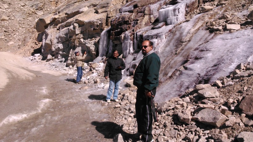
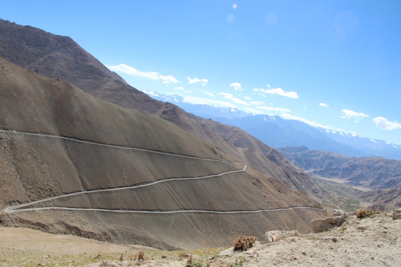
The road was narrow for the most part, but thankfully, we found the traffic to be generally thin. We had the first feel of ice, in the form of a small, frozen waterfall, after South Pullu.
The signboard atop Khardung La mentions its altitude as 18,380 ft. and proclaims it as the `highest motorable road in the world’. Visitors are generally advised not to stay for more than 30 minutes on the Top, and some of us soon started to feel the effects of the high altitude.
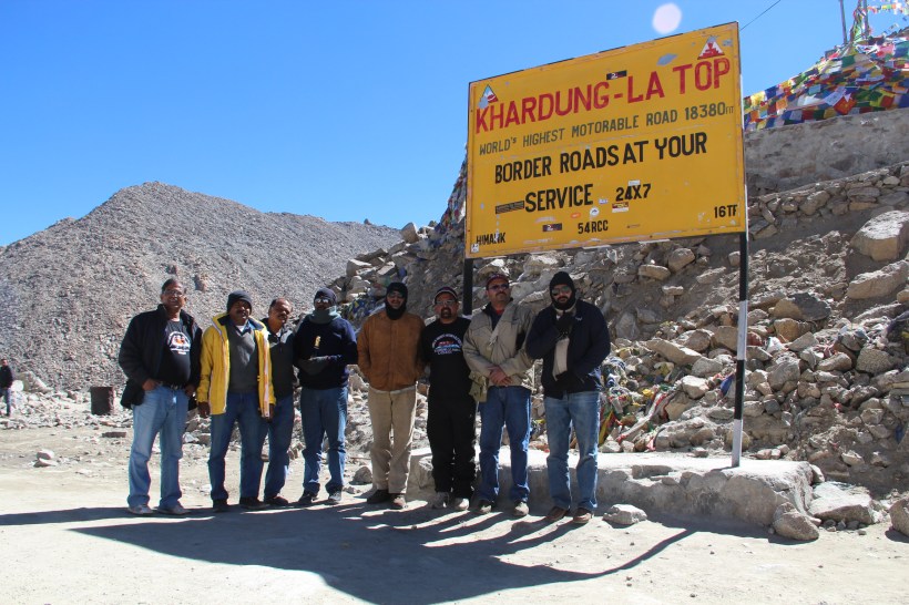
Army post located here offers free hot tea to the visitors and we enjoyed their hospitality for a while, listening to their advices and sipping the nice hot tea.
As we descended into Nubra Valley, we started seeing a slightly different terrain. After we pass Khardung village, the Shyok River appears below.
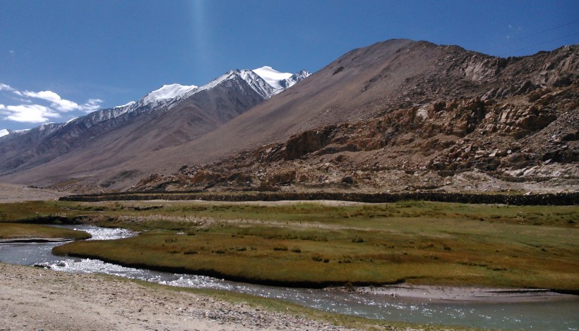
We saw a couple of patches of greenery within the river basin, with ample signs of habitation.
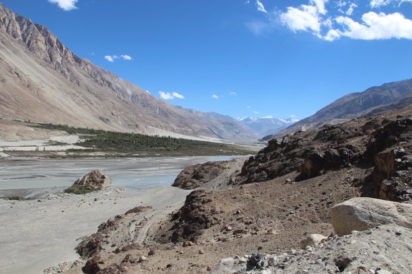
The Nubra River, which is fed by the glacial waters of Siachen Glacier, joins the river Shyok near a place called Diskit. White sand dunes in this region between majestic mountains offered a spectacular view.
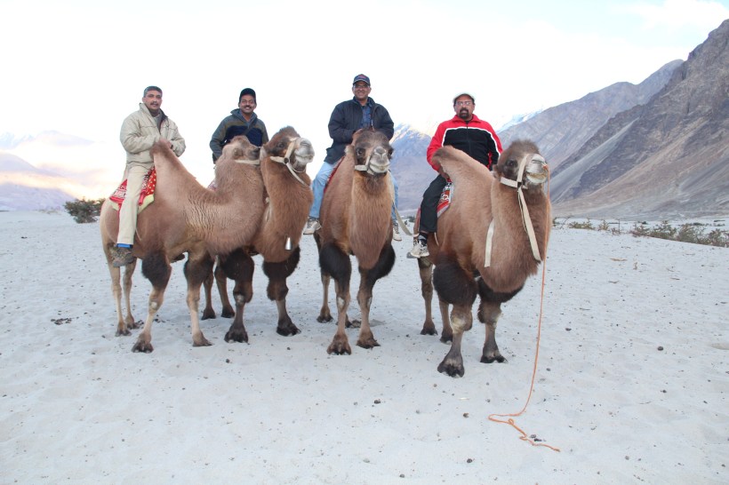
The next village, Hunder has a few Bactrian camels (double humped), which are supposed to be the descendants of those camels which used to ply the ancient Silk Route, the same route by which we came from Leh.
We stayed at the Air Force Station, Thoise (acronym for ‘Transit Halt Of Indian Soldiers Enroute’). Thoise is the northern-most airbase of India, and has the crucial (and difficult) responsibility of providing (actually air-dropping) supplies to the soldiers on Siachen Glacier.
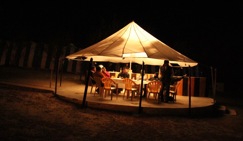
Our hosts threw us a party by the side of the Shyok river, and enlightened us about the local history and geography. The night temperatures were below zero degree centigrade and we survived with the help of multiple blankets and room heaters provided in our Guest Rooms.
Day – 10 Thursday, 19 September 2013 : Thoise-Tangste : 275 km
We had an initial plan to reach our next destination, Pangong Lake, through Khalsar – Agham – Wari La – Sarkthi route, which appeared quite short, on the map but difficult to navigate. After discussing with the Air Force Officers, we dropped this idea and retraced our steps to Leh via Khardung-La, and proceeded in the direction of Pangong Tso, through Karu.
Our lunch consisted of Maggi noodles, at a wayside eatery in Sarkthi, which appears to be the staple food at all small, village food joints in Ladakh. The ascent to the 17,590 ft. pass, Chang La starts shortly after Sarkthi. Even though the gradient is rather steep, the road surface remains quite negotiable, for most part. The board at Chang La Top proclaims it to be the third highest Pass in the world.
After the pass, the topography changed dramatically and we soon reached the plain terrain at Durbuk.. Tangtse, just five kilometers away, houses the Military Garrison, which was to host us for the night.
Day – 11 Friday, 20 September 2013 : Tangste-Lukung-Karu : 170 km
We started after a wonderful breakfast and proceeded to Lukung, just 35 kms away from Tangtse, which is the nearest boundary of Pangong Lake. Lukung is also the end-point of the Lake on the Indian side, which is actually about 130 kms long, extending into China (majority of the Lake now lies in China).
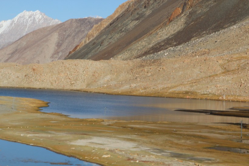
The route was very scenic and a few kilometers before Lukung, we saw a small but beautiful lake Chagar Tso. Tourists usually forget this little jewel, in their rush to get to Pangong.
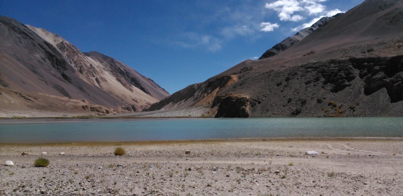
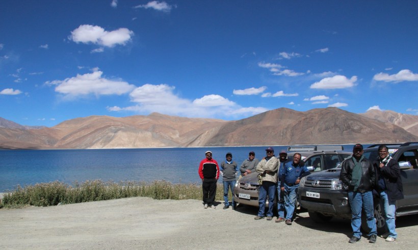
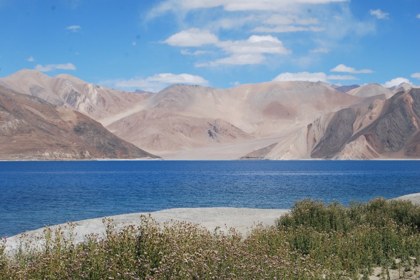
The first sight of Pangong Tso (a bit of the Lake seen through a gap in the mountains) is very exhilarating. The bright blue hue of the water, in the backdrop of the pale mountains, presents a sublime picture indeed.
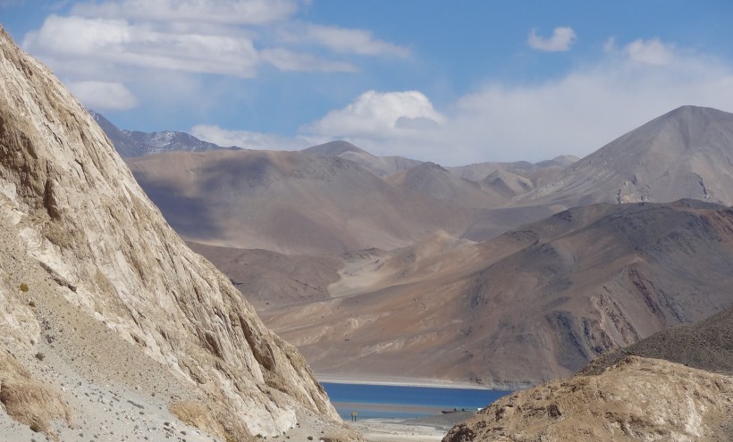
Pangong Lake is one of the few high-altitude salt water lakes. The lake lies at an altitude of 14,400 ft. We were told that Indian Territory currently extends to about 50 kms, along the Lake.
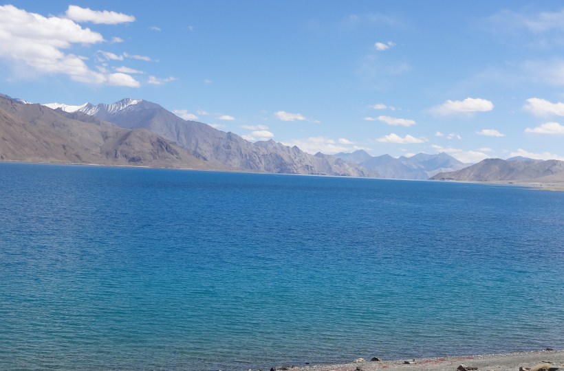
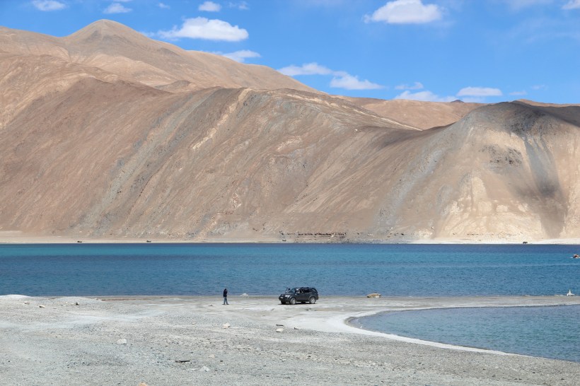
We spent a few hours near the lake enjoying the heavenly beauty of the lake and clicked a few wonderful pictures.
We took our cars to the location where the climax scene of the popular hindi film `Three idiots’ was shot.
We returned and stayed at an Army Guest house at Karu on the Leh – Manali highway.
Day – 12 Saturday, 21 September 2013 : Karu-Patseo : 270 km
There was some anxiety about having to cross four high-altitude Passes in a single day, on the way to Patseo, our destination for the day. However, Tanglang La (17,480 ft), the tallest of the lot, was a smooth ride, thanks to the surprisingly good condition of the road. Descent to the base of Tanglang La brought us to Debring, which is nothing but a clutch of few huts, functioning as local eateries and small lodging facilities. Debring marks the beginning of the strange Morey Plains, which extends like a plateau for about 40 kms, at an average altitude of 14,000 ft.
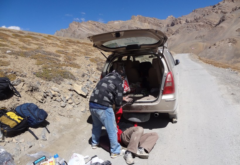
The climb to Lachulung La (16,600 ft) started after Pang, and the condition of the road deteriorated drastically. We soon had the first hitch in our journey and the opportunity to experience the difficulty of changing a flat tyre, at an altitude of about 15,000 ft. We somehow managed it without external help, but lost more than an hour in accomplishing the job.
Another pass Nakee La (15,547 ft.) comes immediately after Lachulung La, so much so that they are often considered as a single pass !
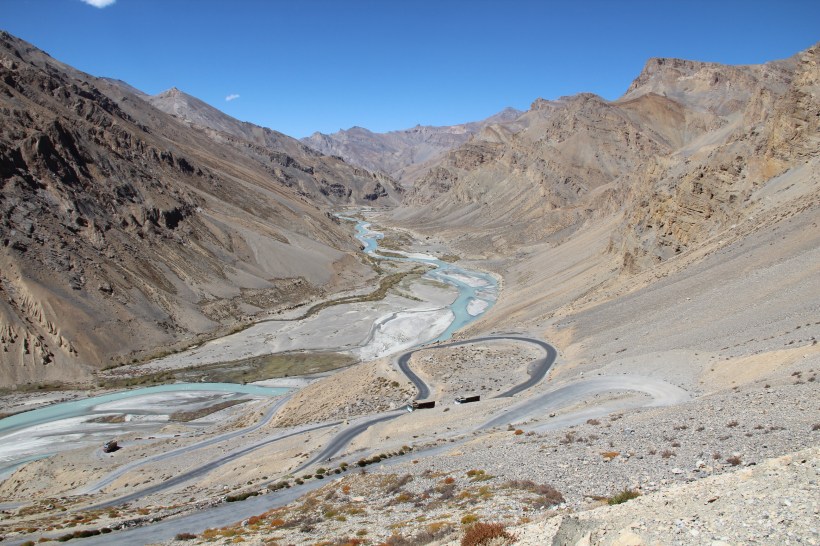
We then came across the famous ‘Gata Loops’, a set of 22 hairpin bends down the mountain, with lots of shortcut tracks. There was a view point at the top, where we could see all the loops and winding roads, a favorite photo location. The 4 Wheel Drive Vehicle Fortuner was taken for a little bit of `off roading’ through the shortcut tracks, but we didn’t try our luck with the Innova on those tracks.
Shortly afterwards we reached Sarchu, a place near the Ladakh – Himachal border, famous for camping and adventure trekking. We found ourselves in an adventurous situation soon, when we reached a place called `Killing Sarai’. The name was apt; there was a sharp turn onto an iron bridge, with large river stones in the approach with an incline, capable of killing vehicles. We had to stop the cars, get down and inspect the area to take the vehicles across, with someone guiding the drivers, by standing outside.
The next pass, Baralacha La (16,043 ft.), the highest pass on the Leh – Manali route, was generally considered to be a difficult Pass to negotiate, somewhat akin to Rohtang Pass. After Baralacha La, the gradual decent brought us to Patseo, our halt for the night.
The third phase of our journey would begin the next day, when we drive to the Spity Valley in Himachal Pradesh.
To be continued…
