
by JAYAPRAKASH P
`Our land is so barren, and the passes so high, that only the best friends or the fiercest enemies come to visit us’– An old Ladakhi saying.
This travelogue is about a trip to one of the most amazing regions of our Country – Ladakh. The name Ladakh means the land of mountain passes, `La’ means pass. Ladakh was a district in the state of Jammu & Kashmir, comprising of majestic Himalayan ranges, stunning glaciers and beautiful valleys. Recently, it has become a Union Territory.
PART 1 : Drive from Bangalore to Leh
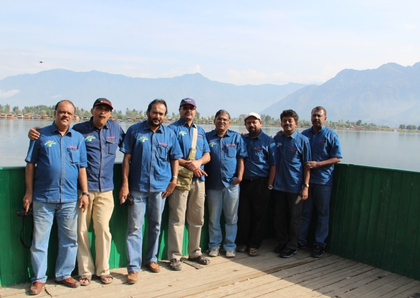
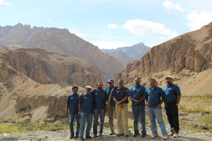
`Birds of the same feather flock together’ – Eight of us from the College of Engineering, Trivandrum : Suresh Kumar, Joseph Andrews, Fenwick Thomas, Ninan Philip, Vijaya Kumar, Ravichander, Oommen Thomas and myself, Jayaprakash had a common passion for driving expeditions. It was in 2012 that our team leader Suresh put forward the idea – `let us drive to Ladakh’ and we were quick to agree. Two of us, the senior most member Andrews and myself, were assigned with the task of preparation of a drive schedule. Detailed studies from data available with books and internet followed and a few drive plans were prepared. It took more than 6 months to form a solid plan after many rounds of `spirited’ discussions and arguments.
We had our apprehensions about the altitudes to scale, condition of roads, security aspects etc., but finally all eight of us decided to go ahead as planned. For a comfortable ride, we chose a Toyota Fortuner 4WD and an Innova. The automobile company, Bosch agreed to sponsor the Innova and agreed to hand over the same from their Jaipur Unit. And we decided to take the Toyota Fortuner belonging to group member Ravichander, from Bangalore. Each member of the team had a role assigned to him – to arrange vehicle spares and accessories, inner line permits, accommodation, food, protective gears, medicines and so on. Even oxygen cylinders were arranged, for use in case of an emergency.
Days 1 to 4 : September 10 – 13, 2013 : Bangalore – Chandigarh : 2675 km
The D-Day finally arrived and the three of us; Andrews, Ninan and myself, started from Bangalore by 4.00PM on 10th September 2013 in the Toyota Fortuner.

After leaving the hectic Bangalore traffic behind, we took our first pit stop at about 6.30PM, somewhere near Chitradurga and enjoyed some homemade sandwiches and coffee. We decided that each person would drive only for two and a half hours at a stretch to avoid fatigue. This decision proved very effective and Andrews closely monitored to ensure the drive timings throughout the trip.
We reached Hubli by 9.30 PM and with the help of Google Maps, located a suitable hotel and checked in. After updating our friends and family about our progress, we had our dinner and retired early. It was going to be a long drive for the next day.
We woke up even before the alarm went off and quickly freshened up. We started by 6AM from Hubli and drove through Pune, Mumbai and Surat, the plan was to reach Baroda for the night halt. After entering Gujarat State, we encountered very heavy rains and the progress was very slow. To add to our woes, there was a massive traffic jam at Baruch Bridge and we ended up checking into a hotel at Bharuch, by 9.30PM. We assessed the situation during dinner and discussed with the team leader. Pune-Mumbai Express Highway was the best road of the day.

Next day, we started by 6.30AM and drove through Baroda and Udaipur to reach Jaipur by 8PM. The road condition was really good and we could make up for the time lost during the previous day. We could reach Jaipur Airport in time to pick up one more member of our team, Fenwick, flying in from Bangalore.
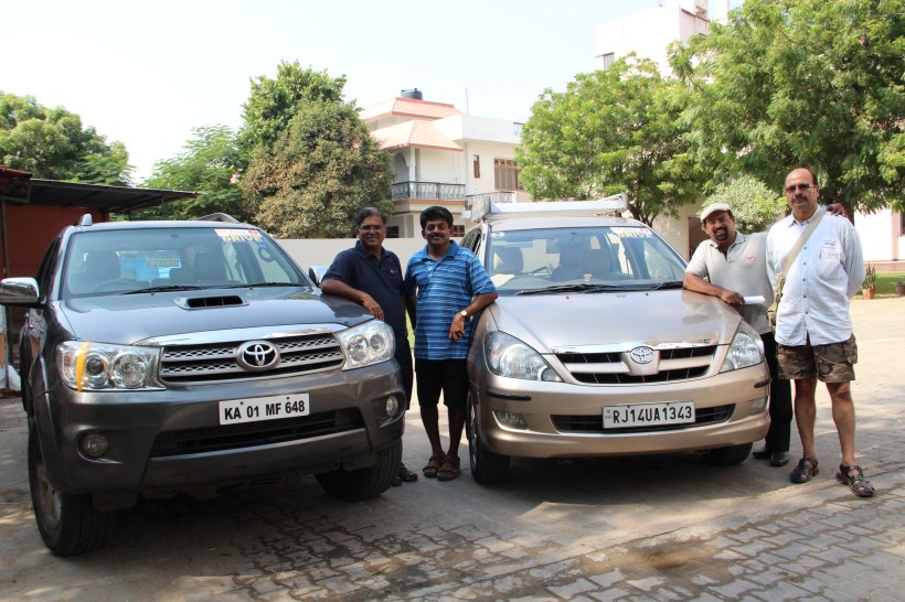
We picked up the second vehicle, Toyota Innova from Bosch, Jaipur by 10AM on September 13. By about 10.30AM the four of us drove out from Jaipur in two vehicles aiming to reach Chandigarh by evening, where the remaining 4 members were scheduled to join us; they too were flying in from Bangalore. There was some confusion in deciding the best route, depending on road conditions and traffic. We finally decided upon the Rewari – Rohtak route and reached Chandigarh by evening. By the time we reached Chandigarh, the other four had already reached the Defense Guest House reserved for our stay and welcomed us with great delight. They were quite surprised that we were still so fresh and energetic even after driving continuously for almost 4 days, covering about 2,700km, without taking any breaks other than for food and night halt. We were all thrilled that our dream drive into the Himalayas would begin the next day.
Day – 5 September 14, 2013 : Chandigarh – Srinagar : 595 km
We managed to start at around 5-30 a.m. and drove into Punjab, via Mohali. Soon, the lush green fields of the rural Punjab greeted us. We had breakfast at a modern dhaba, which served very delicious aloo parathas.
We hit NH-1A at Dasuya, and our pace quickened, for a while.

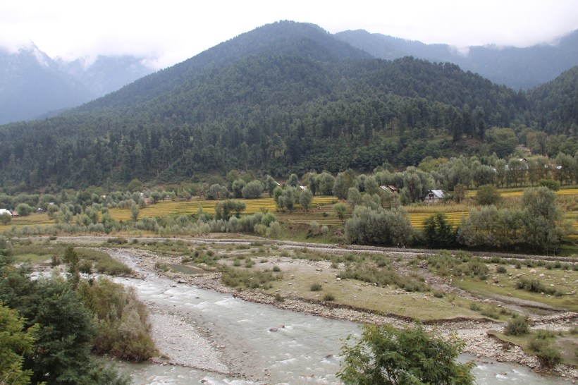
The greenery gradually faded away and we drove in to a barren landscape, as we approached Pathankot.

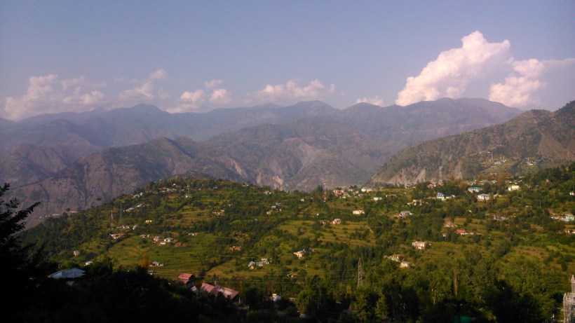
The terrain got surprisingly flat, as we got into the Kashmir Valley. We started seeing a lot of habitation around the highway, with villages and small towns coming up pretty frequently.
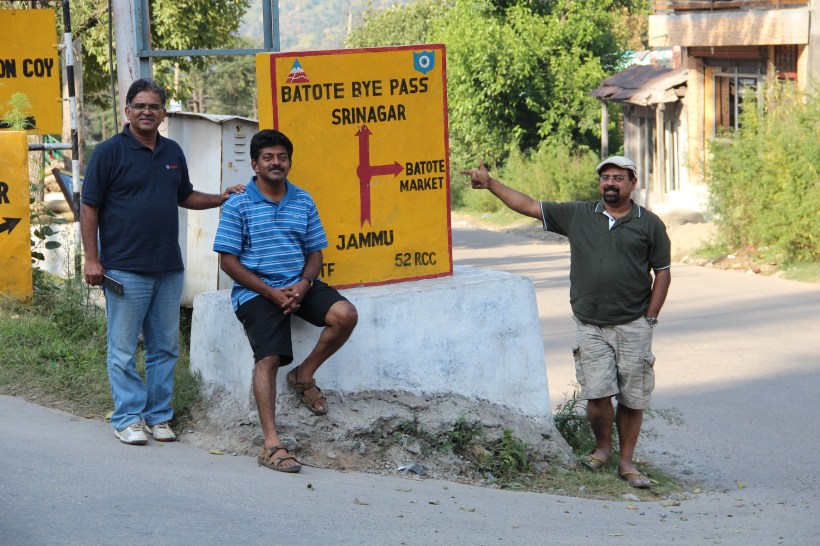
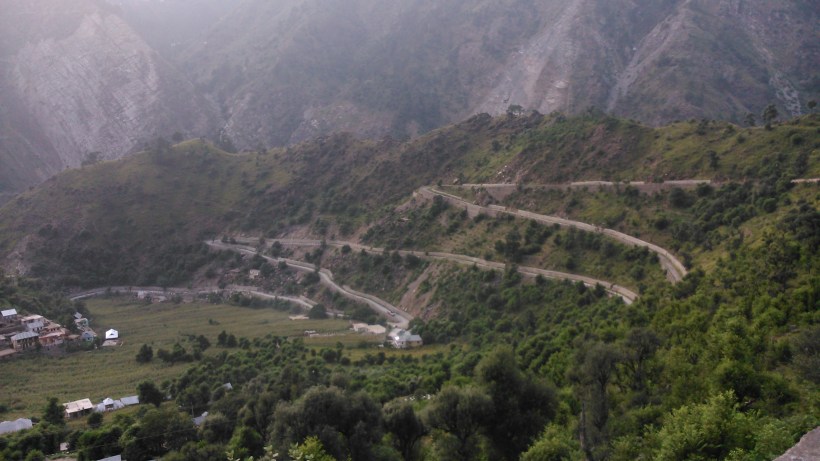
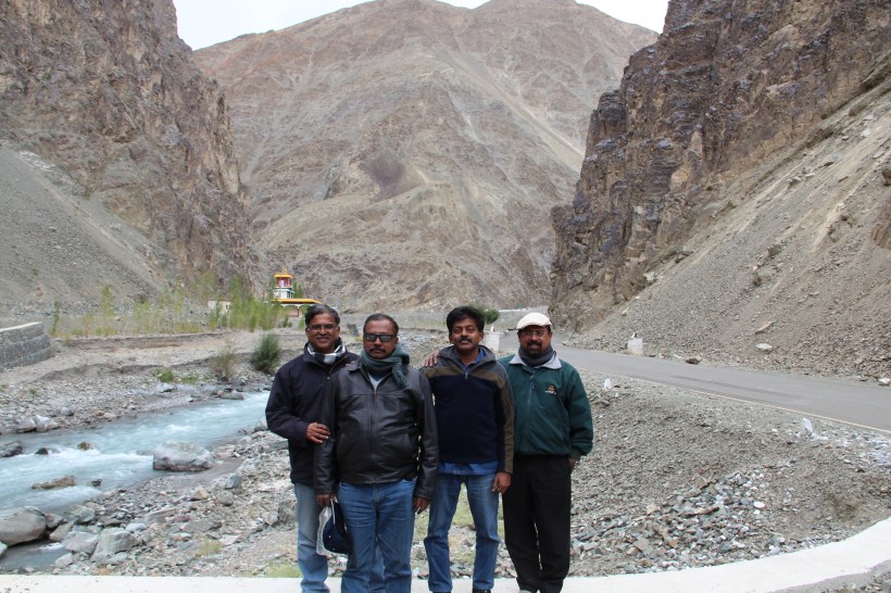
After crossing the hairpin bends at Patnitop and moving ahead, we saw a signboard that read `Batote’ and the nostalgic memories of our CET All India tour flashed through my mind. It was at this place that we got stuck in a massive road block because of a land slide, during our bus journey from Jammu to Srinagar. We were lucky enough to get two rooms in a nearby inn to accommodate the big group of 53 friends for that cold night in 1983. We stopped, had a cup of tea from a local tea shop, clicked a photo and moved on.
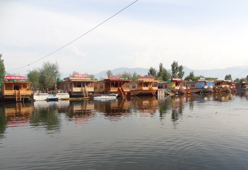
Crossing the 2.85 km long Jawahar Tunnel (Banihal Pass) built during 1954-56, was a unique experience. We reached our destination, a houseboat in Dal Lake at Srinagar, by 7.30 PM.

Dal Lake with its fine backdrop of the mountains was a feast for the eyes.
Day – 6 September 15, 2013 : Srinagar – Kargil : 210 km
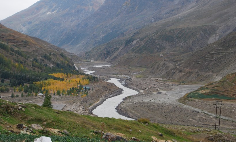
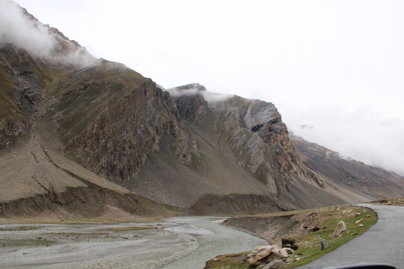
The drive from Srinagar to Kargil was picture perfect, forcing us to stop now and then for photos.
The approach to Sonamarg can surely be rated as one of the most picturesque locations in our entire trip.
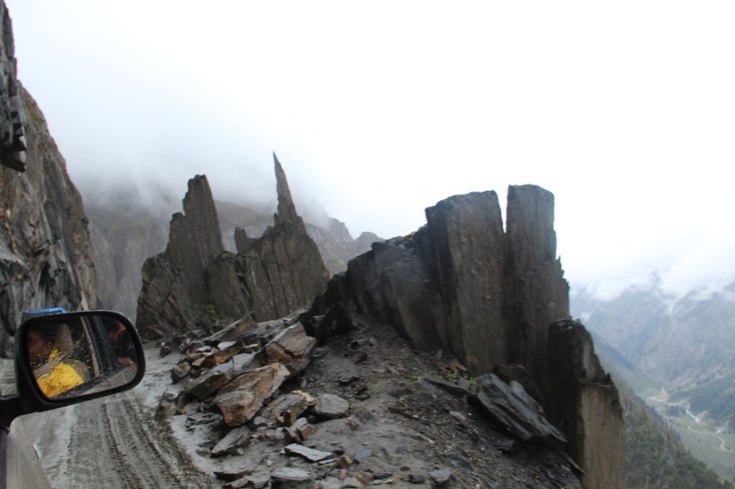
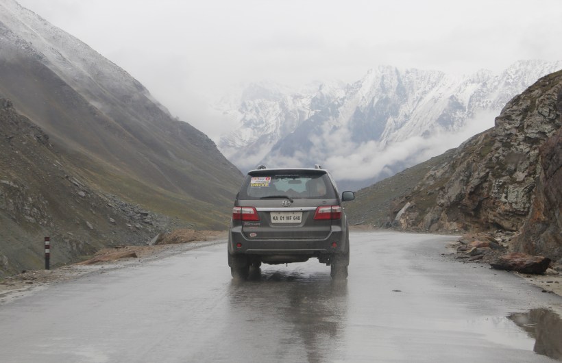
Soon, we reached the dreaded Zojila Pass (11,650 ft.), and then, it started drizzling. For more than ten kilometers, the road was a total mess, and the steep ascent combined with the fine mist, gave us quite a scare. The terrain was extremely fragile, the road surface dangerously slippery, with tall cliff on one side and deep gorge on the other side.
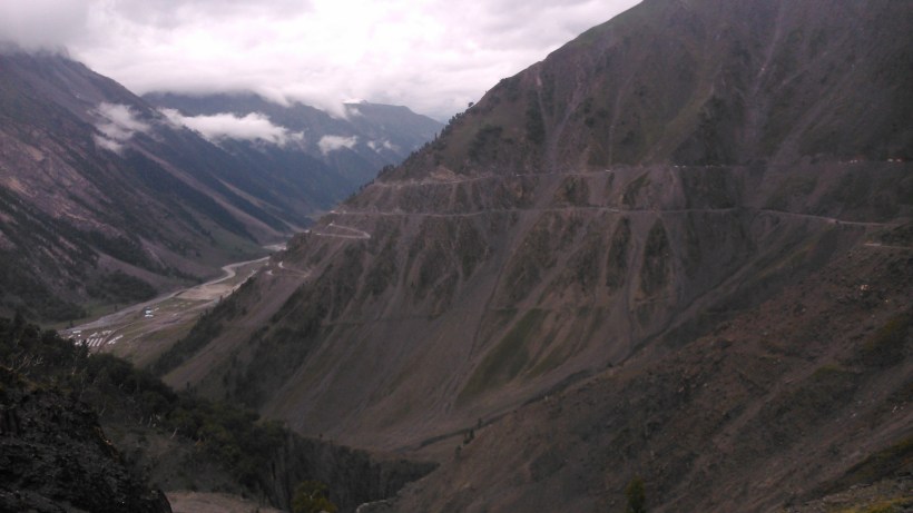
Zojila Pass should rate among one of world’s most treacherous roads. The Fortuner, being a Four Wheel Drive Vehicle, managed to climb the pass without much difficulty, but the Innova without the luxury of a 4 Wheel Drive, began to skid a bit at times, as if to test our driving skills.
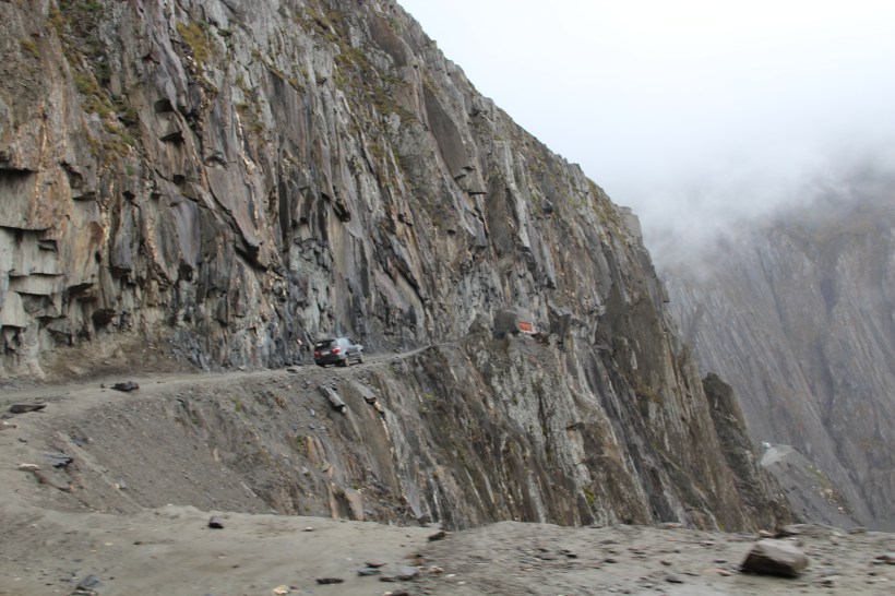
Though the visibility was poor, the one way traffic system followed in the pass gave us some confidence and finally, after a struggle of more than an hour, we reached the top.
As you come down from the Pass, a big signboard welcomes you into Ladakh. We didn’t miss the opportunity to click some pictures, even though it was still drizzling and very cold out there.

The scenery all around with majestic snow capped mountains and beautiful valleys will erase all the worries from your mind.
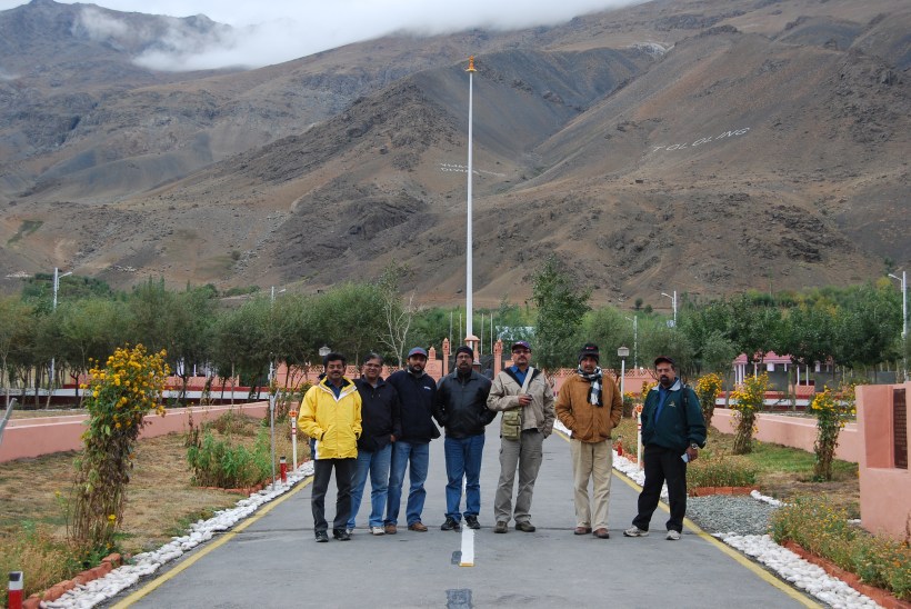
Shortly afterwards we reached Gumri, which houses a small memorial, in honor of the Indian soldiers who lost their lives in Zojila during the war of 1947-48. We had lunch in a small eatery in Drass, a town which boasts itself to be the second coldest inhabited place in the world. A few kilometers further, the Kargil War Memorial is located, which seems to have been built right below the Tiger Hill, from where the Pak incursion took place.
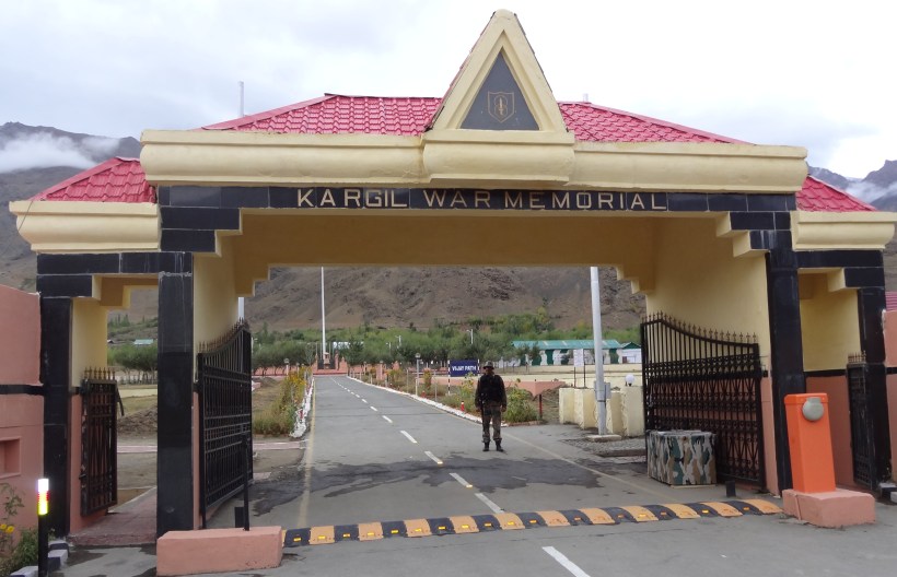
The Amar Jawan Jyoti, and rows of the stone plaques bearing the names of the soldiers who lost their lives during the Kargil War, are sights which will touch your heart deeply.

We spent some time there, paying our respects and chatting with the soldiers on duty.
Our destination for the day was the Army Guest House at Kargil, where we reached just before sunset.
Day – 7 September 16, 2013 : Kargil – Leh : 260 km
Soon after we leave Kargil, the road climbs up to a point where we get a full view of the Kargil town.
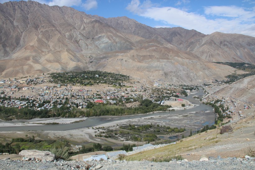
Slowly, the land was getting more barren and barren and then the only green oasis we saw were the small towns. Buildings of the Tibetan style of construction started appearing along the way, and the cultural change towards Budhism became evident.
The road remained fairly smooth for long stretches, which brought smiles on our faces.
After about 15 kilometers from the town of Mulbekh, which is famous for the rock cut Budha, we reached Namika La (12,198 ft.), the second mountain pass in our journey. Namika (which means `Fingers in the sky’) was an easy pass with decent tarmac and gradual slope. Soon we arrived at the highest pass on the Srinagar – Leh highway, the Fotu La (13,478 ft.) which also was cleared without any difficulty.
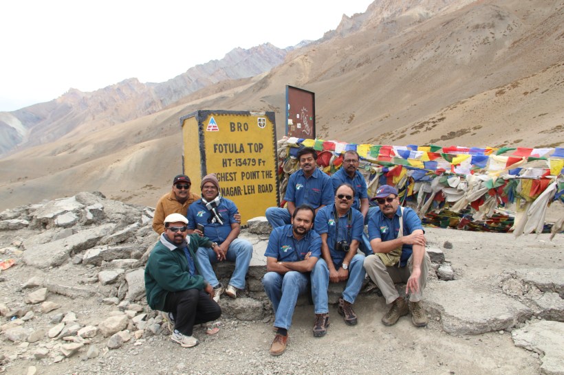
After the customary photo shoots, we continued driving.
We reached the famous Lamayuru, an important seat of Budhism, at noon. The first view of Lamayuru from the road high above, with a monastery perched rather precariously above the town, was really spectacular.
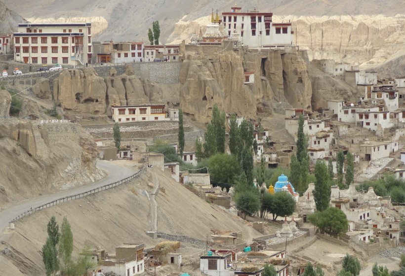
Lamayuru Monastery was built in the 11th century. Lamayuru Moonland, an area just outside the Monastery, is a rock formation with a peculiar, out-of-the-world whitish colour; a favourite spot for photography.
This little town is the gateway for trek routes into the Zanskar valley and we found lots of European tourists there. The Lamayuru – Padum trek route is world famous for the wonderful glacier experience.
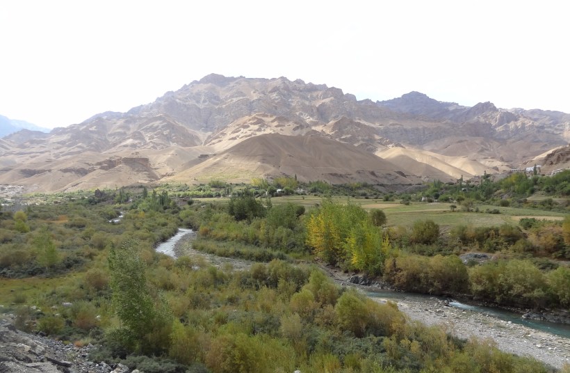
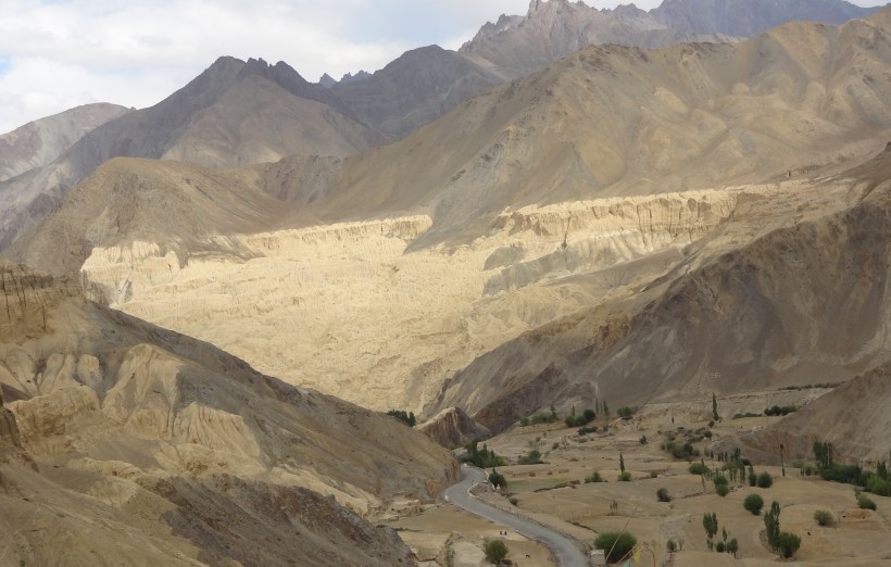
Scenic locations came one after the other prompting us to stop and pose for photos. The crystal clear water flowing through the stream between the mountains was so cold that we dropped the idea of washing our face with it, after dipping our hands in the stream.
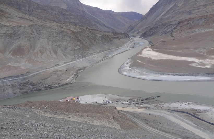
Indus-Zanskar confluence, where the muddy Sanskar meets the clear Indus, is another place of tourist interest en-route Leh.
Yet another interesting location on the way is the ‘Magnetic Hill’, which is supposed to pull vehicles up against gravity. Though our cars (in neutral gear) did move up against the slope, we were not sure whether it was any magnetic force, or the sheer force of wind that moved the cars. Finally, after a bit of thinking and analyzing, we came to the more logical conclusion that the slope in the road was just an optical illusion.
We reached an important milestone of the trip – Leh – by 7 PM.
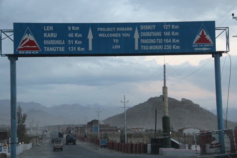
We searched the location of the Army Guest House, where our accommodation was booked through our Army contacts, but couldn’t identify the exact guest house, even after driving around the town for an hour. Since it was already late, the Officers quickly arranged accommodation for us in a brand-new, comfortable Leh Hotel, which offered beautiful views of faraway glaciers.
To be continued…
